
 Home
Home
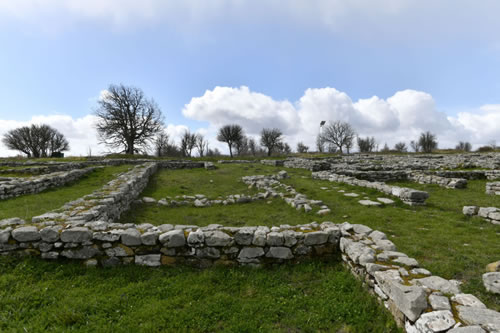
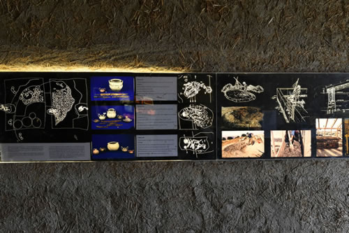
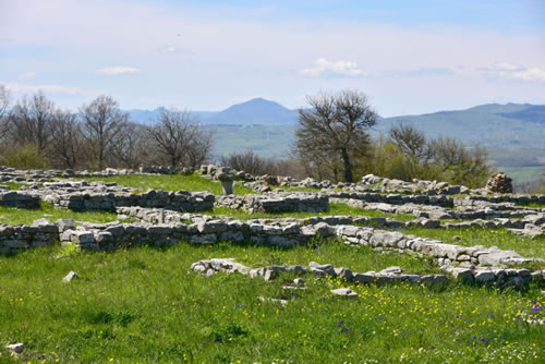
The Archaeological Park of Serra di Vaglio is the archaeological site which is located near the Agriturismo La Dimora dei Cavalieri. Is located in Serra di Vaglio at 1,100 mt above sea level, in a position that dominates the routes along the Basento valley, including the Greek colony of Metaponto and indoor areas and the Tyrrhenian centers of southern Campania.
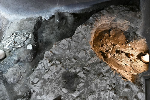
The first phase of the town dates back to the eighth century BC, with groups of huts separated by areas for burials. This town has been attributed to indigenous peoples identified with Peuketiantes, described by Hecataeus of Miletus, and characterized by the burial of the dead in the fetal position.
The Archaeological Park of Serra di Vaglio
To get there you take the road that climbs through the woods to the entrance of the S. Bernardo path, which crosses longitudinally the summit plateau of the hill to the remains of Utilia Bella.
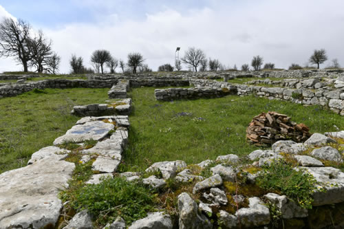
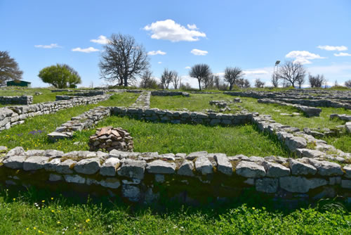
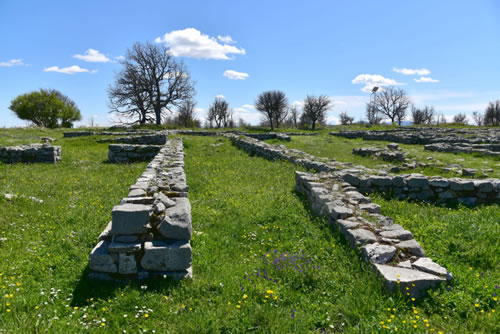
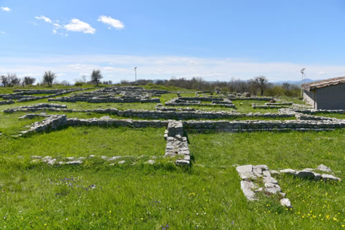
Immediately the visitor can admire of the vast and beautiful landscape, around all the four cardinal points.
The first permanent occupation of the plateau from the second half of the eighth century BC, when it is occupied by circular huts with cobbled paving, plinth stones, and high coverage of raw clay and straw (plastered white inside). These huts are divided into scattered groups, alternating with the burials, with no differentiation between the living area and the cemetery .
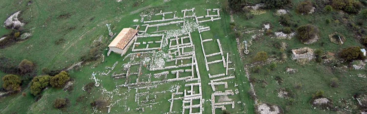
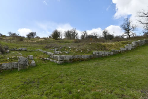
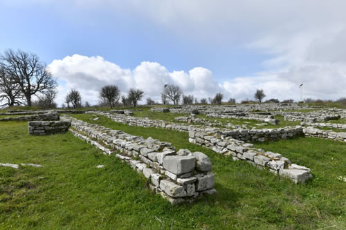
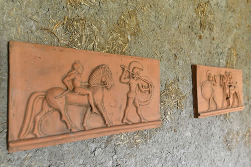
Around the middle of the sixth century, on the plateau of Serra the buildings are lined up on either side of a central road axis and decorated with terracotta, while the burials are progressively removed on the slopes. Between the end of this and in the course of the next century, the structures adopt the rectangular, with internal divisions, and always have a dry stone plinth and high in clay and straw. The long central axis road is paved with large flagstones , flanked by narrow streets perpendicular, while some paved areas remain uncovered and probably destined for public office.
Since the end of the fifth century BC we are witnessing a process of change that is affecting the whole southern Italy: the gradual pressure of the people who will occupy the territory Lucan replacing the previous populations.
The urban layout of Serra di Vaglio is shocked: the village seems to explode to accommodate a greater number of inhabitants, but the process is hasty, large buildings are reused in a disorderly fashion, cut, stamped, invading the central road axis. A complex system of canals affects the whole central area of the plateau.
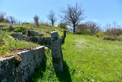
Around the middle of the fourth century BC is erected the massive fortified wall, about 2,5 km long, which encloses the plateau on at least three sides. It was probably only partially on the fourth side , southern, naturally defended by a deep overhang.
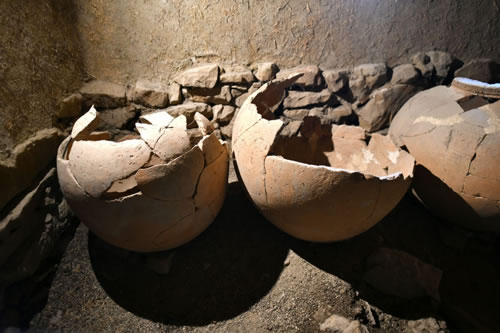
On the right of the excavation is evident in the House of Pithoi, a faithful reconstruction of a building dating from the fourth century BC.
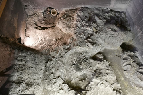
A thick layer of burnt and ashes sealed in the first decades of the third century BC the remains of Serra. The war determined by the pressure of Rome and by the movements of all the Italic peoples probably led to the violent end of the "capital" of Lucania.
Immediately the visitor can admire of the vast and beautiful landscape, around all the four cardinal points.
The first permanent occupation of the plateau from the second half of the eighth century BC, when it is occupied by circular huts with cobbled paving, plinth stones, and high coverage of raw clay and straw (plastered white inside). These huts are divided into scattered groups, alternating with the burials, with no differentiation between the living area and the cemetery .
Around the middle of the sixth century, on the plateau of Serra the buildings are lined up on either side of a central road axis and decorated with terracotta, while the burials are progressively removed on the slopes. Between the end of this and in the course of the next century, the structures adopt the rectangular, with internal divisions, and always have a dry stone plinth and high in clay and straw. The long central axis road is paved with large flagstones , flanked by narrow streets perpendicular, while some paved areas remain uncovered and probably destined for public office.
Since the end of the fifth century BC we are witnessing a process of change that is affecting the whole southern Italy: the gradual pressure of the people who will occupy the territory Lucan replacing the previous populations.
The urban layout of Serra di Vaglio is shocked: the village seems to explode to accommodate a greater number of inhabitants, but the process is hasty, large buildings are reused in a disorderly fashion, cut, stamped, invading the central road axis. A complex system of canals affects the whole central area of the plateau.
Around the middle of the fourth century BC is erected the massive fortified wall, about 2,5 km long, which encloses the plateau on at least three sides. It was probably only partially on the fourth side , southern, naturally defended by a deep overhang.
On the right of the excavation is evident in the House of Pithoi, a faithful reconstruction of a building dating from the fourth century BC.
A thick layer of burnt and ashes sealed in the first decades of the third century BC the remains of Serra. The war determined by the pressure of Rome and by the movements of all the Italic peoples probably led to the violent end of the "capital" of Lucania.